Flood watch advisories issued for Lower Fraser; but Coquitlam, Port Coquitlam not concerned about local flooding
[This article has been updated with comments from the City of Port Coquitlam.]
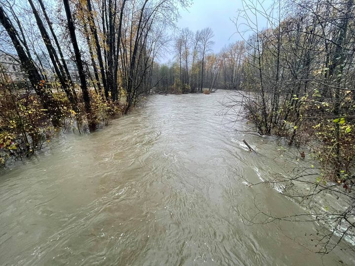
A flood watch advisory has been issued for the northern tributaries flowing into the Fraser River as another atmospheric river looms.
Since Friday, a “series of potent storms” have resulted in 80 to 300 millimetres of rainfall pouring on southwestern B.C., including 40 to 130 millimetres in the past 24 hours, according to the advisory released by the River Forecast Centre.
Local news that matters to you
No one covers the Tri-Cities like we do. But we need your help to keep our community journalism sustainable.
More rain is expected on Wednesday morning, leading to a large number of warnings and advisories to be issued across the region.
However, the cities of Coquitlam and Port Coquitlam are not concerned with flooding along Coquitlam, Pitt and Fraser rivers.
A significant portion of Port Coquitlam is considered a flood plain, but Josh Frederick, director of engineering and public works, said the Pitt River would need to reach 2.7 metres above seas level before the city would have a heightened level of preparedness. As of Jan.31, he said its currently at 1.13 metres high.
“The level on the Pitt River is not predicted to reach our preparation trigger level,” Frederick said.
Frederick said they only activate their planning when the Fraser River measures above 6 metres high at the gauge located at the City of Mission, and physical preparations are only made when above 7 metres. The Mission gauge is not predicted to exceed 2.5 metres, he said.
Coquitlam River only becomes a concern when the flow release from BC Hydro’s Coquitlam dam exceeds 145 cubic metres per second, and BC Hydro has not notified them of any issues.
“The areas where we have most concerns in extreme flooding situations (from outside into the city) is Cedar Drive and Argue Street, both are low-lying but our dikes provide protection up to at least a 1-in-200 year flood event and the current event is around a 1-in-2 to 1-in-5 year level event,” Frederick said. “We continue to monitor the weather situation and staff meet frequently to review the current status and actions required to maintain our level of preparedness and maintain risk levels.
Jonathan Helmus, director of utilities with the City of Coquitlam, said the five-day forecast the province uses to model river flows is nowhere near their capacity limits.
“The current flows of 70 cubic metres per second are projected to moderately increase to 80 cubic metres per second. For comparison, during the November 2021 storm, peak river flow was 200 cubic metres per second,” Helmus said. “We’re not too concerned at this point.”
Aside from periods of heavy rain, the storms will result in temperatures 5 to 10 degrees above seasonal averages, according to Environment Canada.
“Temperatures are expected to warm during this period, and snowmelt at lower and mid-elevations will provide additional runoff to rivers,” the advisory stated. “Flows remain high through the region as runoff from yesterday’s rainfall and snowmelt works its way through river systems.”
The elevated-freezing levels are expected to result in increased snow melt, possibly resulting in flood conditions, landslides in vulnerable areas, as well as falling trees and power outages with accompanying winds, according to Environment Canada.
Flood warnings have already been issued for the Squamish River, and a local state of emergency has been issued for the Village of Pemberton.
In addition, avalanche warnings have been issued for areas around Garibaldi Provincial Park, Squamish, Whistler and Pemberton.
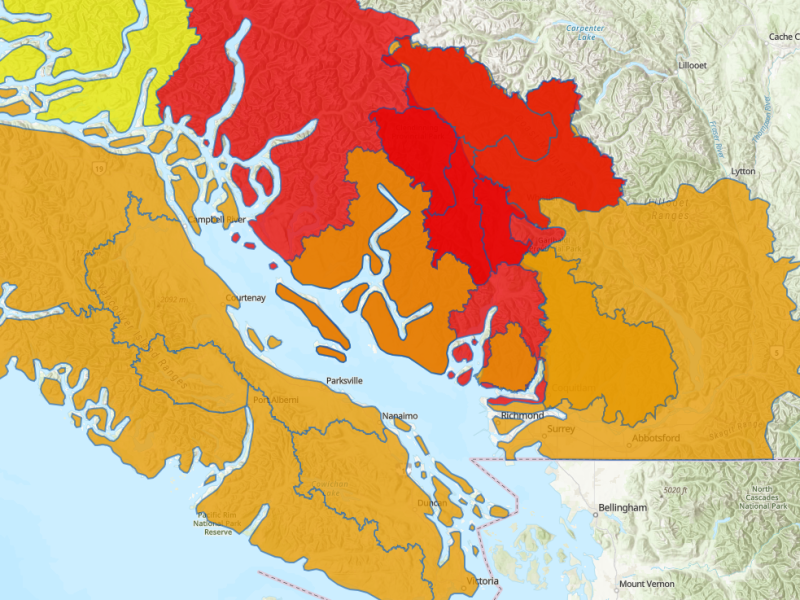
All of Vancouver Island, the Sunshine Coast, the Fraser Valley, and the North Shore mountains have flood watches in effect.
Ongoing hazards from increased river flows are expected on Wednesday and Thursday, although the exact amount of rainfall, and where it will fall, is still uncertain, according to the River Forecast Centre.
“Elevated flood hazards may be possible in nearby areas, particularly if the storm tracks or patterns change from what is currently forecast,” the advisory stated.
Author